
Road Town 🇻🇬
-
Nautical Twilight begins:05:08 amSunrise:05:57 am
-
Sunset:06:52 pmNautical Twilight ends:07:41 pm
-
Moonrise:04:09 pm
-
Moonset:02:14 am
-
Moon over:09:38 pm
-
Moon under:09:11 am
-
Visibility:86%
-
 Waxing Gibbous
-
Distance to earth:398,676 kmProximity:16.5 %
Moon Phases for Road Town
-
poor Day
-
minor Time:01:14 am - 03:14 am
-
major Time:08:11 am - 10:11 am
-
minor Time:03:09 pm - 05:09 pm
-
major Time:08:38 pm - 10:38 pm
| Date | Major Bite Times | Minor Bite Times | Sun | Moon | Moonphase | Tide Times |
|---|---|---|---|---|---|---|
|
Tue, 05 Aug
|
08:11 am -
10:11 am
08:38 pm -
10:38 pm
|
01:14 am -
03:14 am
03:09 pm -
05:09 pm
|
R: 05:57 am S: 06:52 pm |
R: 04:09 pm S: 02:14 am |
Waxing Gibbous |
|
|
Wed, 06 Aug
|
09:06 am -
11:06 am
09:31 pm -
11:31 pm
|
02:10 am -
04:10 am
04:02 pm -
06:02 pm
|
R: 05:57 am S: 06:52 pm |
R: 05:02 pm S: 03:10 am |
Waxing Gibbous |
|
|
Thu, 07 Aug
|
10:00 am -
12:00 pm
10:23 pm -
12:23 am
|
03:08 am -
05:08 am
04:52 pm -
06:52 pm
|
R: 05:57 am S: 06:51 pm |
R: 05:52 pm S: 04:08 am |
Full Moon |
|
|
Fri, 08 Aug
|
10:52 am -
12:52 pm
11:13 pm -
01:13 am
|
04:07 am -
06:07 am
05:37 pm -
07:37 pm
|
R: 05:57 am S: 06:51 pm |
R: 06:37 pm S: 05:07 am |
Full Moon |
|
|
Sat, 09 Aug
|
11:42 am -
01:42 pm
11:22 pm -
01:22 am
|
05:06 am -
07:06 am
06:19 pm -
08:19 pm
|
R: 05:58 am S: 06:50 pm |
R: 07:19 pm S: 06:06 am |
Full Moon |
|
|
Sun, 10 Aug
|
12:12 am -
02:12 am
12:31 pm -
02:31 pm
|
06:05 am -
08:05 am
06:58 pm -
08:58 pm
|
R: 05:58 am S: 06:50 pm |
R: 07:58 pm S: 07:05 am |
Full Moon |
|
|
Mon, 11 Aug
|
01:00 am -
03:00 am
01:19 pm -
03:19 pm
|
07:02 am -
09:02 am
07:36 pm -
09:36 pm
|
R: 05:58 am S: 06:49 pm |
R: 08:36 pm S: 08:02 am |
Waning Gibbous |


uploaded by: Hoza

uploaded by: Hoza

uploaded by: Eric Dixon_1

uploaded by: Eric Dixon_1

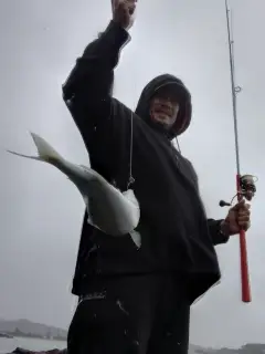
uploaded by: Joey Piercefield

uploaded by: Joey Piercefield

uploaded by: Joey Piercefield

uploaded by: Joey Piercefield

uploaded by: Joey Piercefield

uploaded by: Matthew Kiggins
Road Town,rodotaun,רואוד טאון,ロードタウン
Best Fishing Spots in the greater Road Town area
Beaches and Bays are ideal places for land-based fishing. If the beach is shallow and the water is clear then twilight times are usually the best times, especially when they coincide with a major or minor fishing time. Often the points on either side of a beach are the best spots. Or if the beach is large then look for irregularities in the breaking waves, indicating sandbanks and holes. We found 37 beaches and bays in this area.
Cooper Bay - 2km , Trunk Bay - 3km , Carrot Bay - 3km , Shark Bay - 3km , Brandywine Bay - 4km , Brewers Bay - 4km , Cane Garden Bay - 4km , Josias Bay - 4km , Josias Bay Pond - 4km , Long Bay - 4km , Ballast Bay - 5km , Cooten Bay - 5km , Paraquita Bay - 5km , Apple Bay - 6km , Bar Bay Point - 6km , East End Bay - 6km , Fat Hogs Bay - 6km , Great Carrot Bay - 6km , Little Carrot Bay - 6km , Cappoons Bay - 7km , Long Bay Point - 7km , White Bay - 8km , Sprat Bay - 8km , Sand Pierre Bay - 8km , Conch Bay - 9km , Sprat Bay Point - 9km , Deadman Bay - 9km , Muskmelon Bay - 9km , Trellis Bay - 9km , North Bay - 9km , Big Reef Bay - 9km , Well Bay - 9km , Low Bay - 10km , Lower Belmont Bay - 10km , Lee Bay - 10km , Key Bay - 10km , Tom Bogard Bay - 10km
Harbours and Marinas can often times be productive fishing spots for land based fishing as their sheltered environment attracts a wide variety of bait fish. Similar to river mouths, harbour entrances are also great places to fish as lots of fish will move in and out with the rising and falling tides. There are 5 main harbours in this area.
Road Harbour - 2km, Nanny Cay Marina - 3km, Great Harbour Point - 7km, Little Harbour - 8km, Great Harbour - 8km
We found a total of 95 potential fishing spots nearby Road Town. Below you can find them organized on a map. Points, Headlands, Reefs, Islands, Channels, etc can all be productive fishing spots. As these are user submitted spots, there might be some errors in the exact location. You also need to cross check local fishing regulations. Some of the spots might be in or around marine reserves or other locations that cannot be fished. If you click on a location marker it will bring up some details and a quick link to google search, satellite maps and fishing times. Tip: Click/Tap on a new area to load more fishing spots.
Little Wickham’s Cay - 1km , Shirley Point - 1km , Cooper Bay - 2km , Slaney Point - 2km , Road Harbour - 2km , Nanny Cay Marina - 3km , Trunk Bay - 3km , Burt Point - 3km , Tortola - 3km , Carrot Bay - 3km , Shark Bay - 3km , Angilla Point - 4km , Brandywine Bay - 4km , Brewers Bay - 4km , Cane Garden Bay - 4km , Du Bois Point - 4km , Half Moon Point - 4km , Hogs Valley Point - 4km , Josias Bay - 4km , Josias Bay Pond - 4km , Long Bay - 4km , Myall Point - 4km , Rough Point - 4km , Whelk Point - 5km , Rogue’s Point - 5km , Ballast Bay - 5km , Cooten Bay - 5km , Nora Hazel Point - 5km , Paraquita Bay - 5km , Brewers Point - 6km , Apple Bay - 6km , Bar Bay Point - 6km , East End Bay - 6km , Fat Hogs Bay - 6km , Fischer Point - 6km , Great Carrot Bay - 6km , Little Carrot Bay - 6km , Monkey Point - 6km , Queen Elizabeth II Bridge - 7km , Black Point - 7km , Bongreys - 7km , Buck Island - 7km , Cappoons Bay - 7km , Great Harbour Point - 7km , Long Bay Point - 7km , Peter Island - 7km , Rock Hole - 7km , Little Harbour - 8km , Key Cay - 8km , Beef Island Channel - 8km , Belmont Pond - 8km , Cabey Point - 8km , Dead Chest - 8km , Great Harbour - 8km , The Iguana Head - 8km , Key Point - 8km , Long Point - 8km , White Bay - 8km , Sprat Bay - 8km , Sand Pierre Bay - 8km , Conch Bay - 9km , Guana Island - 9km , Gun Point - 9km , South East East Land - 9km , Sprat Bay Point - 9km , Dicky Ground - 9km , Little Cay - 9km , Deadman Bay - 9km , Muskmelon Bay - 9km , Sandy Spit - 9km , Norman Island - 9km , Trellis Bay - 9km , North Bay - 9km , Big Reef Bay - 9km , Pelican Island - 9km , Belmont Point - 9km , Well Bay - 9km , Bellamy Cay - 9km , Rogers Point - 9km , Barracouth Point - 10km , Low Bay - 10km , Lower Belmont Bay - 10km , Lee Bay - 10km , Crawl Point - 10km , Man Head - 10km , Conch Shell Point - 10km , Key Bay - 10km , Tom Bogard Bay - 10km , Little Camanoe - 10km , Tower Point - 10km , Frenchmans Cay - 10km , Green Cay - 10km , North East East End - 10km , Dead Water Point - 10km , Pull and be Damn Point - 10km
Comments